![](/images/other/stat-length.png)
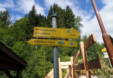
![Trail On foot Mühlbach am Hochkönig - Mühlbach-Pronebenalm-Karbachalm - Photo](https://media.geolcdn.com/t/1900/400/3d7a7ddf-10fa-4d47-a362-cb5930ed8e60.jpeg&format=pjpeg&maxdim=2)
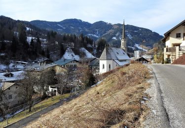
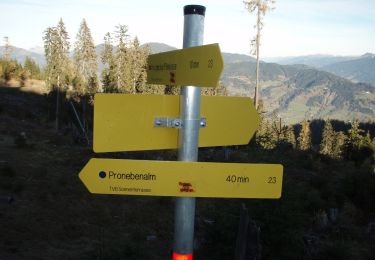
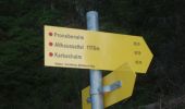
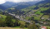
Mühlbach-Pronebenalm-Karbachalm
SityTrail - itinéraires balisés pédestres
Tous les sentiers balisés d’Europe GUIDE+
![Length](/images/other/stat-length.png)
Length
12 km
![Max alt](https://static1.geolcdn.com/siteimages/upload/files/1508320355ic_sort_altitude_max_24dp.png)
Max alt
1510 m
![Uphill gradient](https://static1.geolcdn.com/siteimages/upload/files/1508320355ic_sort_den_pos_24dp.png)
Uphill gradient
282 m
![Km-Effort](/images/other/stat-length.png)
Km-Effort
17.9 km
![Min alt](https://static1.geolcdn.com/siteimages/upload/files/1508320355ic_sort_altitude_min_24dp.png)
Min alt
838 m
![Downhill gradient](https://static1.geolcdn.com/siteimages/upload/files/1508320355ic_sort_den_neg_24dp.png)
Downhill gradient
925 m
![Boucle](https://static1.geolcdn.com/siteimages/upload/files/16400158638029165_repeat_loop_refresh_sync_direction_icon.png)
Boucle
No
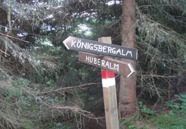
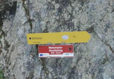
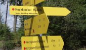
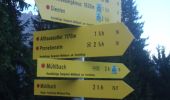
Signpost
Creation date :
2022-02-16 16:24:14.596
Updated on :
2022-03-03 07:31:41.388
![On foot](https://static1.geolcdn.com/sitytour/trail-icons/100.png)
4h03
Difficulty : Easy
![Scan this QR Code to open this trail in the SityTrail application](https://capi.geolives.com/qq0zvz2zws4bq2lad0pu/sitytour/trails/3126957/qr.png?size=200)
FREE GPS app for hiking
About
Trail On foot of 12 km to be discovered at Salzburg, Bezirk St. Johann im Pongau, Mühlbach am Hochkönig. This trail is proposed by SityTrail - itinéraires balisés pédestres.
Description
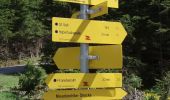
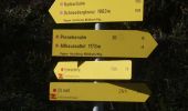
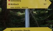
Trail created by TVB Hochkönig.
Symbol: rot-weiss-rot
Positioning
Country:
Austria
Region :
Salzburg
Department/Province :
Bezirk St. Johann im Pongau
Municipality :
Mühlbach am Hochkönig
Location:
Unknown
Start:(Dec)
Start:(UTM)
355845 ; 5248859 (33T) N.
Comments
Trails nearby
![Trail On foot Mühlbach am Hochkönig - Mühlbach-Brennerköpfl - Photo](https://media.geolcdn.com/t/375/260/32854a2f-78da-46b2-8da7-784e392eed1d.jpeg&format=jpg&maxdim=2)
![On foot On foot](https://static1.geolcdn.com/sitytour/trail-icons/100.png)
Mühlbach-Brennerköpfl
On foot
Easy
Mühlbach am Hochkönig,
Salzburg,
Bezirk St. Johann im Pongau,
Austria
![](/images/other/stat-length.png)
3.7 km | 9 km-effort
2h 2min
![](https://static1.geolcdn.com/siteimages/upload/files/16400158638029165_repeat_loop_refresh_sync_direction_icon.png)
No
![Trail On foot Mühlbach am Hochkönig - Mühlbach-Althaussattel - Photo](https://media.geolcdn.com/t/375/260/3d7a7ddf-10fa-4d47-a362-cb5930ed8e60.jpeg&format=jpg&maxdim=2)
![On foot On foot](https://static1.geolcdn.com/sitytour/trail-icons/100.png)
Mühlbach-Althaussattel
On foot
Easy
Mühlbach am Hochkönig,
Salzburg,
Bezirk St. Johann im Pongau,
Austria
![](/images/other/stat-length.png)
3.9 km | 7.4 km-effort
1h 41min
![](https://static1.geolcdn.com/siteimages/upload/files/16400158638029165_repeat_loop_refresh_sync_direction_icon.png)
No
![Trail On foot Dienten am Hochkönig - Sonnberg-Königsbergalm - Photo](https://media.geolcdn.com/t/375/260/0dbab340-c11e-4f8b-80d8-87d045357c87.jpeg&format=jpg&maxdim=2)
![On foot On foot](https://static1.geolcdn.com/sitytour/trail-icons/100.png)
Sonnberg-Königsbergalm
On foot
Easy
Dienten am Hochkönig,
Salzburg,
Bezirk Zell am See,
Austria
![](/images/other/stat-length.png)
3.5 km | 6.9 km-effort
1h 33min
![](https://static1.geolcdn.com/siteimages/upload/files/16400158638029165_repeat_loop_refresh_sync_direction_icon.png)
No
![Trail On foot Dienten am Hochkönig - Schwarzenbachtal-Hirtenkapelle - Photo](https://media.geolcdn.com/t/375/260/0b915dfc-f400-4cff-ae8c-f65c2305edd4.jpeg&format=jpg&maxdim=2)
![On foot On foot](https://static1.geolcdn.com/sitytour/trail-icons/100.png)
Schwarzenbachtal-Hirtenkapelle
On foot
Easy
Dienten am Hochkönig,
Salzburg,
Bezirk Zell am See,
Austria
![](/images/other/stat-length.png)
6.1 km | 10.9 km-effort
2h 28min
![](https://static1.geolcdn.com/siteimages/upload/files/16400158638029165_repeat_loop_refresh_sync_direction_icon.png)
No
![Trail On foot Sankt Veit im Pongau - St. Veit-Hochglocker (Alternative) - Photo](https://media.geolcdn.com/t/375/260/899c8403-0f99-4ac0-827f-f9449fad44c5.jpeg&format=jpg&maxdim=2)
![On foot On foot](https://static1.geolcdn.com/sitytour/trail-icons/100.png)
St. Veit-Hochglocker (Alternative)
On foot
Easy
Sankt Veit im Pongau,
Salzburg,
Bezirk St. Johann im Pongau,
Austria
![](/images/other/stat-length.png)
5.5 km | 10.9 km-effort
2h 28min
![](https://static1.geolcdn.com/siteimages/upload/files/16400158638029165_repeat_loop_refresh_sync_direction_icon.png)
No
![Trail On foot Sankt Veit im Pongau - Urpass-Stötzlbergalm-Hochegg - Photo](https://media.geolcdn.com/t/375/260/f152401a-509f-4bfe-a58c-1d9ef65d8bd4.jpeg&format=jpg&maxdim=2)
![On foot On foot](https://static1.geolcdn.com/sitytour/trail-icons/100.png)
Urpass-Stötzlbergalm-Hochegg
On foot
Easy
Sankt Veit im Pongau,
Salzburg,
Bezirk St. Johann im Pongau,
Austria
![](/images/other/stat-length.png)
8.9 km | 19.6 km-effort
4h 26min
![](https://static1.geolcdn.com/siteimages/upload/files/16400158638029165_repeat_loop_refresh_sync_direction_icon.png)
No
![Trail On foot Sankt Veit im Pongau - Urpass-Gamskögerl-Hochegg - Photo](https://media.geolcdn.com/t/375/260/f152401a-509f-4bfe-a58c-1d9ef65d8bd4.jpeg&format=jpg&maxdim=2)
![On foot On foot](https://static1.geolcdn.com/sitytour/trail-icons/100.png)
Urpass-Gamskögerl-Hochegg
On foot
Easy
Sankt Veit im Pongau,
Salzburg,
Bezirk St. Johann im Pongau,
Austria
![](/images/other/stat-length.png)
7.4 km | 16.6 km-effort
3h 46min
![](https://static1.geolcdn.com/siteimages/upload/files/16400158638029165_repeat_loop_refresh_sync_direction_icon.png)
No
![Trail On foot Sankt Veit im Pongau - St. Veit-Schneeberg - Photo](https://media.geolcdn.com/t/375/260/87693ea7-0607-4be9-9af3-5f09f26add33.jpeg&format=jpg&maxdim=2)
![On foot On foot](https://static1.geolcdn.com/sitytour/trail-icons/100.png)
St. Veit-Schneeberg
On foot
Medium
Sankt Veit im Pongau,
Salzburg,
Bezirk St. Johann im Pongau,
Austria
![](/images/other/stat-length.png)
9.3 km | 22 km-effort
4h 54min
![](https://static1.geolcdn.com/siteimages/upload/files/16400158638029165_repeat_loop_refresh_sync_direction_icon.png)
No
![Trail On foot Sankt Veit im Pongau - St. Veit-Hochglocker über Kinderalm - Photo](https://media.geolcdn.com/t/375/260/85503fc7-c1c6-42f0-bb4b-9a0988de790b.jpeg&format=jpg&maxdim=2)
![On foot On foot](https://static1.geolcdn.com/sitytour/trail-icons/100.png)
St. Veit-Hochglocker über Kinderalm
On foot
Easy
Sankt Veit im Pongau,
Salzburg,
Bezirk St. Johann im Pongau,
Austria
![](/images/other/stat-length.png)
6.8 km | 14.6 km-effort
3h 19min
![](https://static1.geolcdn.com/siteimages/upload/files/16400158638029165_repeat_loop_refresh_sync_direction_icon.png)
No